
Erongo Inland
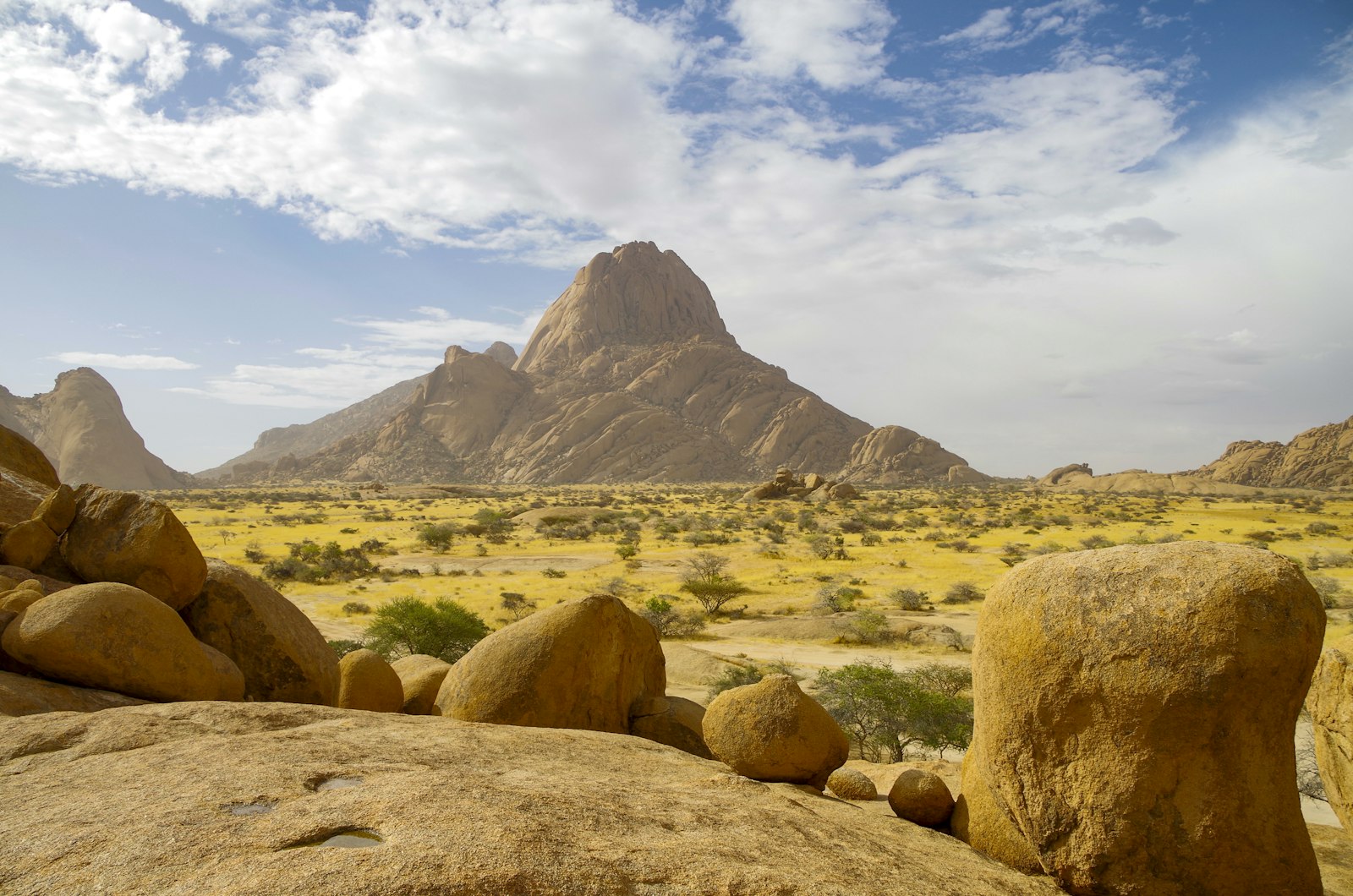
Dramatic granite peaks and inselbergs in the Namibian heartland
Destinations › Erongo Inland

Erongo Inland covers the corridor of small towns and dramatic granite scenery linking central Namibia to the coast, most famously the striking spire of Spitzkoppe and the volcanic bulk of the Erongo Mountains. It is a region many travellers drive straight through on the B2 between Windhoek and Swakopmund, but Spitzkoppe alone is worth deliberately building time into an itinerary for, and the wider Erongo massif holds rock art, geology and scenery that reward a slower pace.
Erongo Inland at a glance
- Region: the inland corridor between Windhoek/Central Namibia and the Namibia Coast
- Main towns: Omaruru, Karibib, Usakos, Arandis
- Known for: Spitzkoppe, the Erongo Mountains, rock art at Phillips Cave, semi-precious stone trade
- Suits: travellers driving between Windhoek and the coast who want to break the journey with genuine scenery
- Access: directly on the B2
Geographic setting
This region lies along the main B2 corridor connecting Windhoek and central Namibia to Swakopmund and the coast, defined geologically by the granite domes and inselbergs of the Erongo Mountains and the isolated peak of Spitzkoppe rising from the surrounding plains to the north.
Erongo Mountains landscape and climate
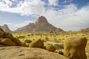
The Erongo Mountains are the eroded remnant of an ancient volcanic complex, now a landscape of huge rounded granite boulders, domes and valleys supporting surprisingly rich plant and animal life for such an arid-looking region. Spitzkoppe, sometimes called the “Matterhorn of Namibia” for its sharp granite profile, rises dramatically from flat gravel plains nearby. The climate is transitional between the cooler, foggy coast and the warmer interior, with low rainfall and mild winters.
Historical context
This corridor was important during the German colonial period as part of the route and rail line linking Windhoek to the coast, and Karibib, Usakos and Omaruru all grew as railway and mission towns through this period; Omaruru in particular retains a well-known Rhenish mission church from the late nineteenth century. A full destination guide to Omaruru is available, covering its galleries, mission history and the surrounding Erongo Mountains.
Arandis was purpose-built in the twentieth century to house workers for the nearby Rössing uranium mine, one of the largest open-pit uranium mines in the world, reflecting the region’s significant mineral wealth alongside its scenic granite landscapes. Phillips Cave, in the Erongo Mountains, holds San rock art thought to be many centuries old, including a well-known painting of a white elephant that has drawn researchers and visitors for decades.
Cultural context
The region’s towns reflect a mix of German-Namibian mission and mining heritage alongside Damara, Herero and other communities who have lived across this landscape for generations. Karibib and Usakos in particular are also known within Namibia for small-scale semi-precious stone trading, including tourmaline and other gemstones found locally, sold from roadside stalls and small shops.
Why visit
Spitzkoppe is one of Namibia’s most photogenic landscapes, particularly at sunrise and sunset, and camping beneath its granite peaks is a highlight for many self-drive travellers. A full destination guide is available. The wider Erongo Mountains offer rock art, hiking and guest-farm stays for those willing to leave the B2 for a day or two, making this region far more rewarding than its usual role as a drive-through corridor suggests.
Main towns and settlements
Omaruru is a historic town with a well-preserved Rhenish mission church and a number of art galleries and studios, set against the backdrop of the Erongo Mountains. Karibib is known for marble quarrying and semi-precious stone trading. Usakos retains a strong railway-town heritage and character. Arandis is a purpose-built mining town serving the nearby Rössing uranium mine.
Places in this region
Individual destination guides cover each place in more depth.
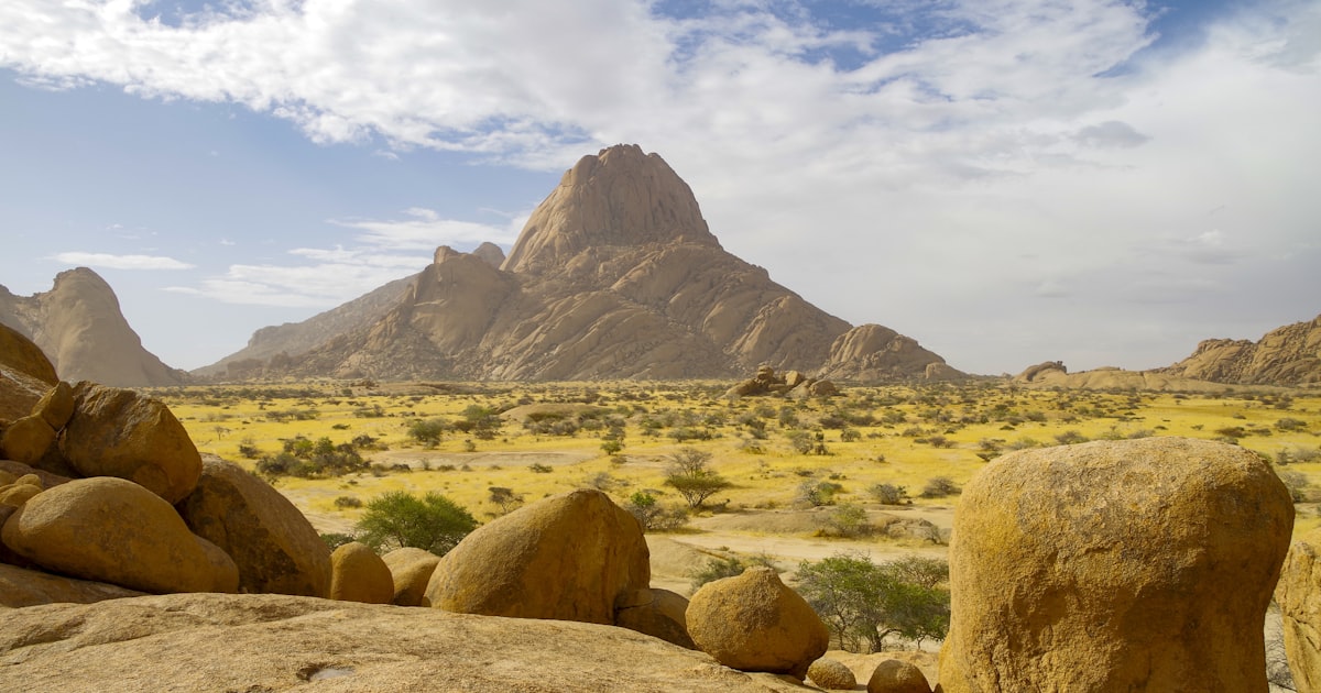
Spitzkoppe. Namibia’s best-known granite inselberg, popular for camping and photography.
Explore »
Omaruru. A small arts-and-crafts town beneath the Erongo Mountains.
Explore »Natural attractions and historic sites
Spitzkoppe, a sharp granite inselberg rising abruptly from the plains, is the region’s most famous landmark, offering camping, a natural rock arch, and San rock art sites, with guided walks available locally. The Erongo Mountains more broadly offer hiking, birding and guest-farm-based exploration of their granite valleys and domes. Ameib, a farm and nature reserve within the Erongo massif, gives access to Phillips Cave and its well-known rock art, including the celebrated “white elephant” painting, reached via a short guided or self-guided walk.
Suggested self-drive routes
Travellers driving the B2 between Windhoek and Swakopmund can detour north from Usakos to Spitzkoppe for a night of camping beneath the peaks, or turn off near Karibib toward Omaruru and the Ameib area for Phillips Cave and Erongo Mountain scenery, before rejoining the B2 further along.
Typical route connections
The B2 runs the length of this region, linking Windhoek and Central Namibia in the east to Swakopmund and the Namibia Coast in the west. Minor roads connect Omaruru north toward Kamanjab and Damaraland via Uis and the Brandberg.
Best time to visit
This region can be visited year-round; the dry winter months (May to September) offer cooler, more comfortable conditions for camping and hiking around Spitzkoppe and the Erongo Mountains.
Suggested length of stay
Most travellers add one night to their Windhoek-coast journey to camp at Spitzkoppe or stay at a guest farm in the Erongo Mountains; two nights allows time for both Spitzkoppe and a Phillips Cave excursion without rushing.
Accommodation context
Spitzkoppe offers basic community-run campsites among the rocks, with no formal chalets at the site itself. Omaruru and the wider Erongo Mountains have a good range of guest farms and lodges, while Karibib and Usakos have smaller guesthouses aimed mainly at travellers passing through.
Ready to compare places to stay? Browse our Erongo Inland accommodation listings for guesthouses, lodges, guest farms and camps across Omaruru, Spitzkoppe, Uis and the Usakos corridor.
Where to stay and what to book in inland Erongo
Inland Erongo covers Omaruru, Karibib, Usakos and the Spitzkoppe and Erongo Mountains. Beds are spread between small town guesthouses and granite-country lodges. These three span the range.
Places to stay near inland Erongo
Roidina Safari Lodge
Bush lodge on a farm property near Omaruru with double rooms quoted room-only, in Erongo foothill country.
Price Guide: N$2,100
View Property DetailsSpitzkoppen Lodge
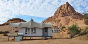
Design lodge set among the granite domes at Spitzkoppe, with glass-fronted chalets on a half-board basis.
Price Guide: N$13,000
View Property Details

Check live availabilityBrowse all inland Erongo accommodation
Tours and activities in Spitzkoppe
Spitzkoppe Day Tour from Swakopmund
Visit Namibia's granite Matterhorn on this full-day Spitzkoppe day tour from Swakopmund with Bushman rock art and…
View Tour DetailsSpitzkoppe Day Tour from Walvis Bay
This full-day tour travels from Walvis Bay up the coast and inland to Spitzkoppe, the granite inselberg often…
View Tour DetailsSpitzkoppe Full Day Adventure from Swakopmund
An 8-hour guided day trip from Swakopmund to the granite peaks, rock formations and San rock art of Spitzkoppe.
View Tour Details
See all Spitzkoppe tours and activities
Some booking links are affiliate links. We may earn a commission at no extra cost to you. See our affiliate disclosure.
Road and vehicle considerations and geology
The B2 is fully tarred and suitable for any vehicle. Access roads to Spitzkoppe and into the Erongo Mountains are gravel, generally manageable in a standard sedan in dry conditions, though a higher-clearance vehicle is more comfortable on some farm and reserve tracks. The region’s granite geology, part of an ancient volcanic complex, also underlies its mineral wealth, including the uranium deposits mined near Arandis and the semi-precious stones traded around Karibib and Usakos.
Route stops on the B2: Karibib and Usakos
Karibib and Usakos are stops rather than destinations, and both are more useful to a driving plan than an itinerary. Karibib grew around marble quarrying and still trades on stone: the roadside gemstone and mineral dealers are the reason most travellers pull in, alongside fuel and a bakery break at roughly the halfway mark between Windhoek and the coast. Usakos, further west, was a railway town and retains something of that heritage; it is also the practical turn-off for travellers heading towards Spitzkoppe and the Erongo mountains.
Neither town warrants a detour in its own right, which is why neither has a separate guide here. Both are worth knowing about when you are planning fuel, food and a leg-stretch on the B2.
Nearby regions
Erongo Inland borders Windhoek and Central Namibia to the east, the Namibia Coast to the west, and Damaraland to the north via Uis and the Brandberg.
Existing and future destination guides
Full destination guides are available for Spitzkoppe and Omaruru. There is no separate guide to the Erongo Mountains yet; this hub page currently provides the main information on them.
Frequently asked questions
Is Spitzkoppe worth a detour from the B2?
Yes, most self-drive travellers who visit consider it one of the most rewarding short detours in Namibia, particularly for photography at sunrise and sunset.
Can I camp at Spitzkoppe without a booking?
Booking ahead is advisable, particularly in busier periods, though community campsites at Spitzkoppe have historically operated on a fairly informal basis; confirm current arrangements before travelling.
Is Phillips Cave easy to reach?
Yes, it is reached via a short walk from the Ameib farm and reserve area in the Erongo Mountains, suitable for most reasonably fit visitors.
Last reviewed: July 2026.
Adding Erongo to your route?
Erongo Inland is an easy detour between Windhoek and the coast or Damaraland. See Destinations and Itineraries for route ideas.
Self-Drive Namibia guideLast reviewed: 27 July 2026.