
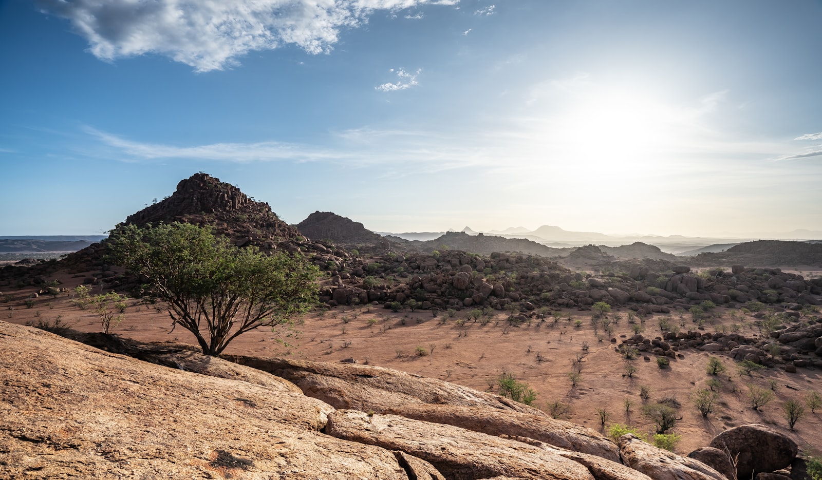
Damaraland
A vast, sparsely populated region of ancient rock art, desert-adapted elephants and dramatic mountain scenery, linking the Skeleton Coast to Etosha and the central plateau.
Destinations › Damaraland
Geographic setting
Damaraland lies between the Skeleton Coast to the west and Etosha and the central plateau to the east, forming a transitional zone of dry mountains, gravel plains and ephemeral rivers such as the Ugab and Huab. It is named for the Damara people, one of Namibia’s oldest indigenous groups, though the region has no formal administrative boundary and is best understood as a loosely defined travel and geological zone rather than a single political unit.
Landscape and climate
This is a land of exposed geology: volcanic remnants, ancient lava flows, petrified forests and huge granite inselbergs rising abruptly from flat gravel plains. Rainfall is low and unreliable, and the region’s rivers flow only after rare heavy rain, yet enough underground water persists to support both permanent settlements and desert-adapted wildlife. Days are hot and dry for most of the year, with cooler winter nights (May to August) and a small chance of thunderstorms in the summer months.
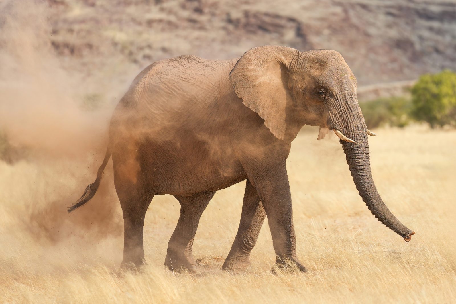
Damaraland’s desert-adapted elephants roam unusually large home ranges along ephemeral rivers such as the Huab and Aba-Huab, browsing on riverine vegetation that survives long after the rains have passed. Tracking them on foot or by vehicle with an experienced local guide, rather than waiting at a fixed waterhole, is one of the most distinctive wildlife experiences available in Namibia.
Historical context
Damaraland takes its name from the Damara (also called Nu-Khoe or ǂNūkhoen) people, believed to be among the oldest inhabitants of this part of southern Africa, whose history and language are distinct from neighbouring Herero and Nama groups despite some shared Khoekhoe linguistic roots.
During apartheid-era South African administration, the area was designated as a “homeland” for Damara people under the Odendaal Plan, a policy of ethnic territorial separation that restricted movement and land rights; this history is part of why the region’s boundaries and identity remain somewhat informal today, since the homeland system was dismantled after Namibian independence in 1990. Twyfelfontein’s rock engravings, some thought to be at least 2,000 years old and possibly considerably older, were made by San hunter-gatherers over a long period, reflecting a much deeper human history in this landscape than the more recent Damara and colonial-era history.
Cultural context
Damara communities remain present across the region today, and community conservancies, including areas around Twyfelfontein and Palmwag, give local residents a direct stake in wildlife tourism revenue, an approach credited with helping desert-adapted elephant and rhino populations recover from historic poaching pressure. Visitors are encouraged to use community-run campsites, guides and craft stalls where available, since these channels benefit local residents directly rather than only outside operators.
Why visit
Damaraland rewards travellers who want dramatic scenery and genuine wildlife tracking rather than guaranteed sightings from a vehicle at a waterhole. Twyfelfontein’s rock art is unlike anything else in Namibia, the Brandberg and Spitzkoppe-style granite scenery is superb for photography, and the chance to track desert-adapted elephant on foot or by vehicle with an experienced guide is a genuinely different experience from a conventional safari.
Main towns and settlements
Khorixas is the region’s main administrative town and a natural fuel and supply stop, and a full destination guide is available covering it as a base for Twyfelfontein, the Petrified Forest and Vingerklip. Uis, a former tin-mining town at the foot of the Brandberg, has reinvented itself around tourism and mountain-biking events and is a common base for Brandberg excursions. Kamanjab, on the region’s eastern fringe toward Etosha, is a small crossroads town and a base for several cheetah sanctuaries in the surrounding farmland.
National parks, reserves and conservancies
Palmwag Concession and the neighbouring Grootberg area are community-and-private conservation areas known for desert-adapted elephant and one of the most successful free-ranging black rhino populations in Africa, generally visited via guided tracking excursions rather than independent self-drive game viewing.
Natural attractions and historic sites
Twyfelfontein, Namibia’s first UNESCO World Heritage Site, holds one of the largest concentrations of rock engravings in Africa, created by San hunter-gatherers depicting animals, tracks and abstract symbols; it is visited with a mandatory local guide. A full destination guide is available. The Brandberg (“fire mountain”), Namibia’s highest peak at around 2,606 metres, is sacred to several communities and holds the famous “White Lady” rock painting in the Tsisab Ravine, a shamanic figure whose early “white lady” interpretation by European researchers has since been widely revised by rock art specialists; it is reached via a guided half-day hike.
Nearby, the Petrified Forest preserves fossilised tree trunks around 280 million years old, while the Organ Pipes (columnar dolerite rock) and Burnt Mountain (a dark, mineral-streaked hill, striking at sunset) sit close together and are usually visited as a combined stop. Vingerklip, a tall isolated rock pinnacle near Khorixas, is another distinctive geological landmark and a popular sundowner viewpoint.
Tours and Activities
Damaraland and nearby Spitzkoppe are often explored with a guide, particularly for interpreting the San rock engravings at Twyfelfontein, tracking desert-adapted elephants, or a guided sunset visit among the Spitzkoppe granite peaks. A guided vehicle also helps on some of the rougher tracks in the area.
Compare bookable options for the area, including typical duration and traveller reviews, via our Damaraland and Spitzkoppe tours and activities listings.
Suggested self-drive routes
A common route runs from the Namibia Coast or Erongo Inland via Uis to the Brandberg, then on to Twyfelfontein, the Petrified Forest, Organ Pipes and Burnt Mountain as a combined half-day stop, continuing to Palmwag or Grootberg for desert-elephant tracking before exiting north toward Sesfontein and Kaokoland, or east via Kamanjab toward Etosha.
Typical route connections
The C39 and C40 gravel roads connect Damaraland to the Namibia Coast in the west and Kamanjab and Etosha in the east. The C43 runs north from Palmwag toward Sesfontein and on into Kaokoland and Kunene, while the C35 links Uis and Khorixas south toward Erongo Inland and the Swakopmund-Windhoek corridor.
Best time to visit
Damaraland can be visited year-round. The dry winter months (May to September) are generally the most comfortable for hiking and wildlife tracking, while summer (November to March) brings higher temperatures and a small chance of dramatic rain events that can briefly bring dry riverbeds to life.
Suggested length of stay
Two nights is a reasonable minimum to take in Twyfelfontein, the Brandberg area and one desert-elephant tracking excursion without rushing; three or four nights allows a more relaxed pace and time to add Vingerklip or additional hikes.
Accommodation context
Accommodation ranges from community campsites near Twyfelfontein and Uis to mid-range and upmarket lodges around Palmwag and Grootberg, several of them run in partnership with local conservancies. Khorixas and Kamanjab have a small number of guesthouses aimed at travellers passing through.
Ready to compare places to stay? Browse our Damaraland accommodation listings for lodges, camps and guest farms across the region, with indicative nightly rates and live availability.
Where to stay and what to book in Damaraland
Damaraland accommodation is spread thinly along the C39 and D2612 rather than clustered in a town, so booking ahead matters more here than almost anywhere else in Namibia. These three span camping to a well-known desert lodge.
Places to stay near Damaraland
iGowati Country Hotel
A dependable, affordable town hotel in Khorixas, ideal as a convenient overnight stop and supply point on a…
Price Guide: N$1,116
View Property DetailsMadisa Camp
An inventive, family-run camp of safari tents and campsites set among boulders between Twyfelfontein and the…
Price Guide: N$2,800
View Property DetailsMowani Mountain Camp
A romantic, upmarket tented camp whose thatch-and-canvas suites are woven into a spectacular boulder-strewn hilltop…
Price Guide: N$16,570
View Property Details

Check live availabilityBrowse all Damaraland accommodation
Tours and activities in Damaraland and Spitzkoppe
Spitzkoppe Full Day Adventure from Swakopmund
The Spitzkoppe Full Day Adventure from Swakopmund is a full-day guided excursion that follows the Skeleton Coast…
View Tour DetailsSpitzkoppe Day Tour from Walvis Bay
This full-day tour travels from Walvis Bay up the coast and inland to Spitzkoppe, the granite inselberg often…
View Tour DetailsSpitzkoppe Day Tour from Swakopmund
Visit Namibia's granite Matterhorn on this full-day Spitzkoppe day tour from Swakopmund with Bushman rock art and…
View Tour Details
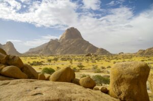
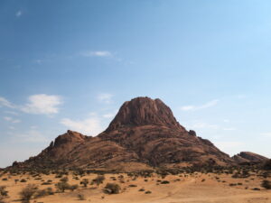
See all Damaraland and Spitzkoppe tours and activities
Some booking links are affiliate links. We may earn a commission at no extra cost to you. See our affiliate disclosure.
Road and vehicle considerations
Almost all roads within Damaraland are gravel, some corrugated or sandy in patches, and a vehicle with higher clearance is strongly recommended even though a careful driver can manage many routes in a standard sedan in good conditions. Distances between fuel stops can be considerable, so planning fuel stops in advance matters more here than in central Namibia.
Fuel, supplies and practical services
Khorixas, Uis and Kamanjab all have basic fuel and supplies, but selection is limited compared with Windhoek or the coast, and travellers should not assume every stop will have fuel available; carrying a reserve is sensible practice throughout this region.
Responsible travel
Twyfelfontein’s rock engravings are irreplaceable and must not be touched, and visitors must stay with their guide on the marked route. As elsewhere in Namibia, rhino locations should never be shared publicly. Supporting community conservancy campsites, guides and craft cooperatives directly benefits the residents whose tolerance of wildlife makes this region’s conservation successes possible.
Nearby regions
Damaraland connects to the Namibia Coast to the west, Kaokoland and Kunene to the north via Sesfontein, Etosha and Central North to the east via Kamanjab, and Erongo Inland to the south via Uis and the Brandberg area.
Related destination guides
Twyfelfontein, Uis and Khorixas now have their own detailed destination guides, alongside the wider Kaokoland and Kunene region immediately to the north.
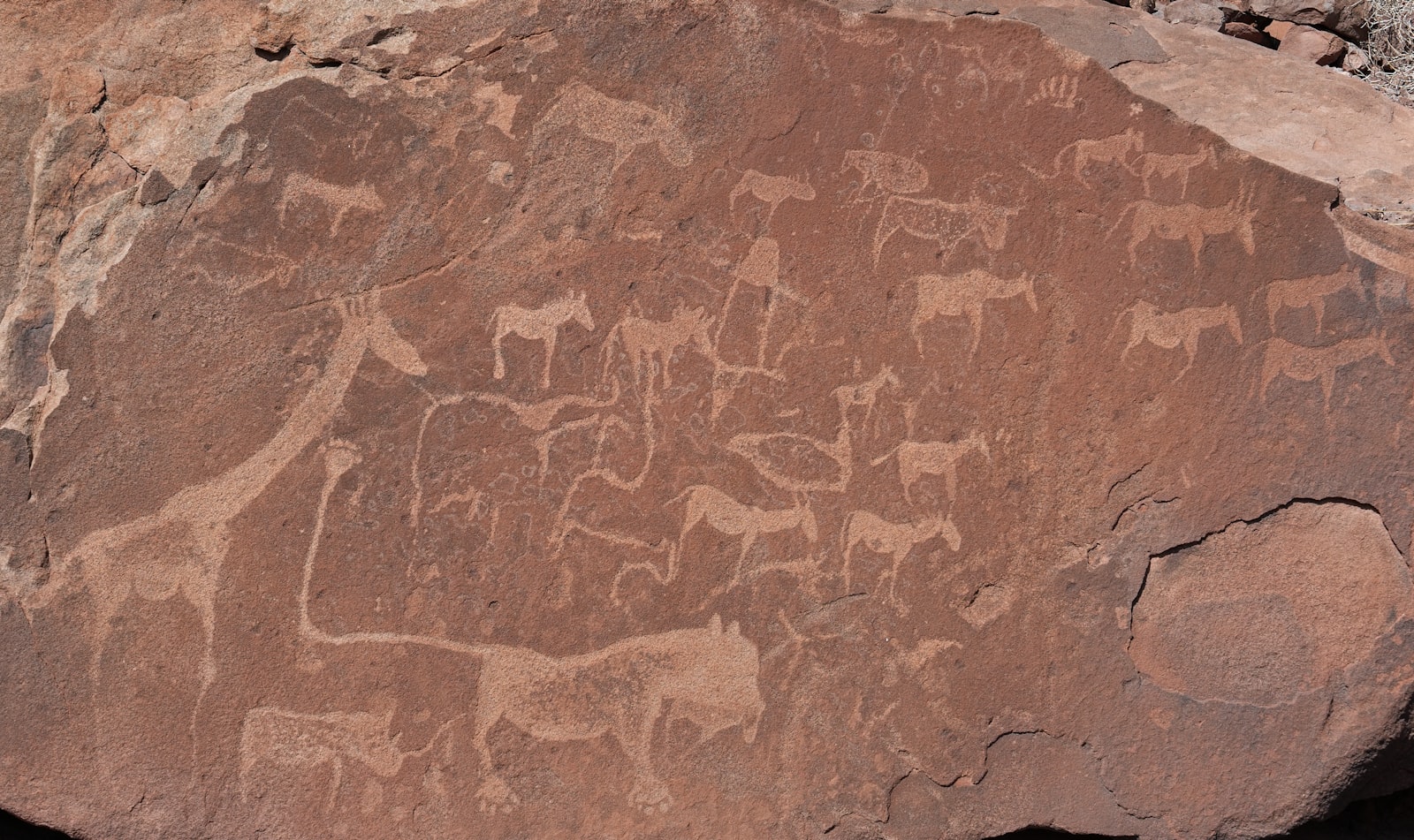
Twyfelfontein. Namibia’s first UNESCO World Heritage Site and one of Africa’s largest concentrations of San rock engravings.
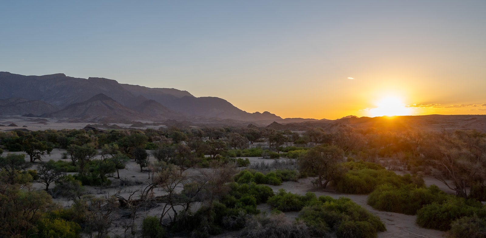
Uis. Small former mining town at the foot of the Brandberg, Namibia’s highest mountain and home of the White Lady painting.

Khorixas. Damaraland’s administrative centre and gateway to the Vingerklip rock pinnacle and the Petrified Forest.
Kaokoland and Kunene. The wilder, more remote region immediately to the north, reached via Sesfontein and Palmwag.
Frequently asked questions
Do I need a 4×4 for Damaraland?
A high-clearance vehicle is strongly recommended, though experienced drivers can manage many main gravel routes in a standard sedan in good, dry conditions. Conditions can change after rain, so check locally before setting out.
Is Twyfelfontein easy to visit independently?
Yes. The site has a visitor centre and mandatory local guides who lead a fixed walking route through the engravings; no advance booking is normally required, though this can change.
Am I guaranteed to see desert-adapted elephants?
No. These elephants range over large areas and sightings depend on their movements at the time of your visit; an experienced local guide significantly improves your chances but nothing can be guaranteed with free-ranging wildlife.
Last reviewed: July 2026.
Planning your route through Damaraland?
Damaraland connects naturally with the Skeleton Coast, Kaokoland, Etosha and the Erongo region, making it a flexible link in most self-drive itineraries.
Self-Drive Namibia guide See all destinationsSee the Destinations overview for wider context. Last reviewed: 26 July 2026.
Planning a longer trip? See our Namibia itineraries to see how Damaraland fits into a 7-, 10-, 14- or 21-day route.
Further reading: Damaraland’s gravel and sand tracks catch out a lot of first-time visitors — see Namibia self-drive mistakes to avoid.
Wondering how this compares with the country further north-west? Damaraland vs Kaokoland sets out the real differences in roads, vehicles, time and remoteness.